“The substance of Alaska is pure granite and ice, but its soul is light — the light of endless morning, of creation still going on.”
The Alaskan Panhandle
Alaska, USA
August 2024
One of the most treacherous landscapes on Earth. Its extraordinary landscape is made up of endless coastline, deep forests, and huge glaciers. Seventeen of the highest mountains in the U.S. are here in Alaska… my name is Bear Grylls, and I’m going to show you how to survive one of America’s true wildernesses.
What? I ripped off the transcript from Episode 4 of Man vs Wild? It’s because Alaska is wild in the lack of human - bear wading through salmon run - permafrost - exceedingly harsh - sense of the word. Its capital, Juneau, has a single road that just ends in the woods with no connection to civilization. Its first McDonalds opened in 1982 and ran out of food in 24 hours. In Skagway, population 920, a single cafe advertises access to internet. The Inuit tribes in Alaska have jurisdiction in governing. Bears and bald eagles roam the streets of Ketchikan, which is where you and everyone else in North America get their salmon from.
Climate change threatens the inhabitants of this land more than most places on Earth. The signs are everywhere. Ice carves off regularly from fast-shrinking glaciers in the warming weather and melts quickly, limiting the ice floes that seabirds and walruses rest on. In the Panhandle, increased temperatures destroy underwater kelp forests and entire ecosystems of crabs and shellfish, which sea otters rely on for protection and food. Swaths of national parks are flooded from melted ice breaking through glacial basins.
So yes, like Bear Grylls, it takes real grit to survive in a place that seems to dislike humans so intensely. I’ve gained huge respect for the natives and permanent residents here, who, to make a severe understatement, seem like a tough bunch.
I’m also proud to say that, unlike Grylls, I didn’t drink any of my own urine this whole trip.
The Salmon Capitol of the World
Ketchikan proudly calls itself the “Salmon Capitol of the World” for good reason. All five species of Pacific Salmon - King, Silver, Sockeye, Pink, and Chum - return from as far as California and Japan back to their hatcheries in Ketchikan to spawn and finish their lifecycle. At its peak, this Alaskan fishing town exported more canned salmon than any other port in the world.
The salmon return from June to September, and they come in numbers. Rivers run through the town and salmon run through the rivers. Big dark masses in the water struggle upstream, taking turns sprinting up the rapids. At points, there seem to be more fish than river.
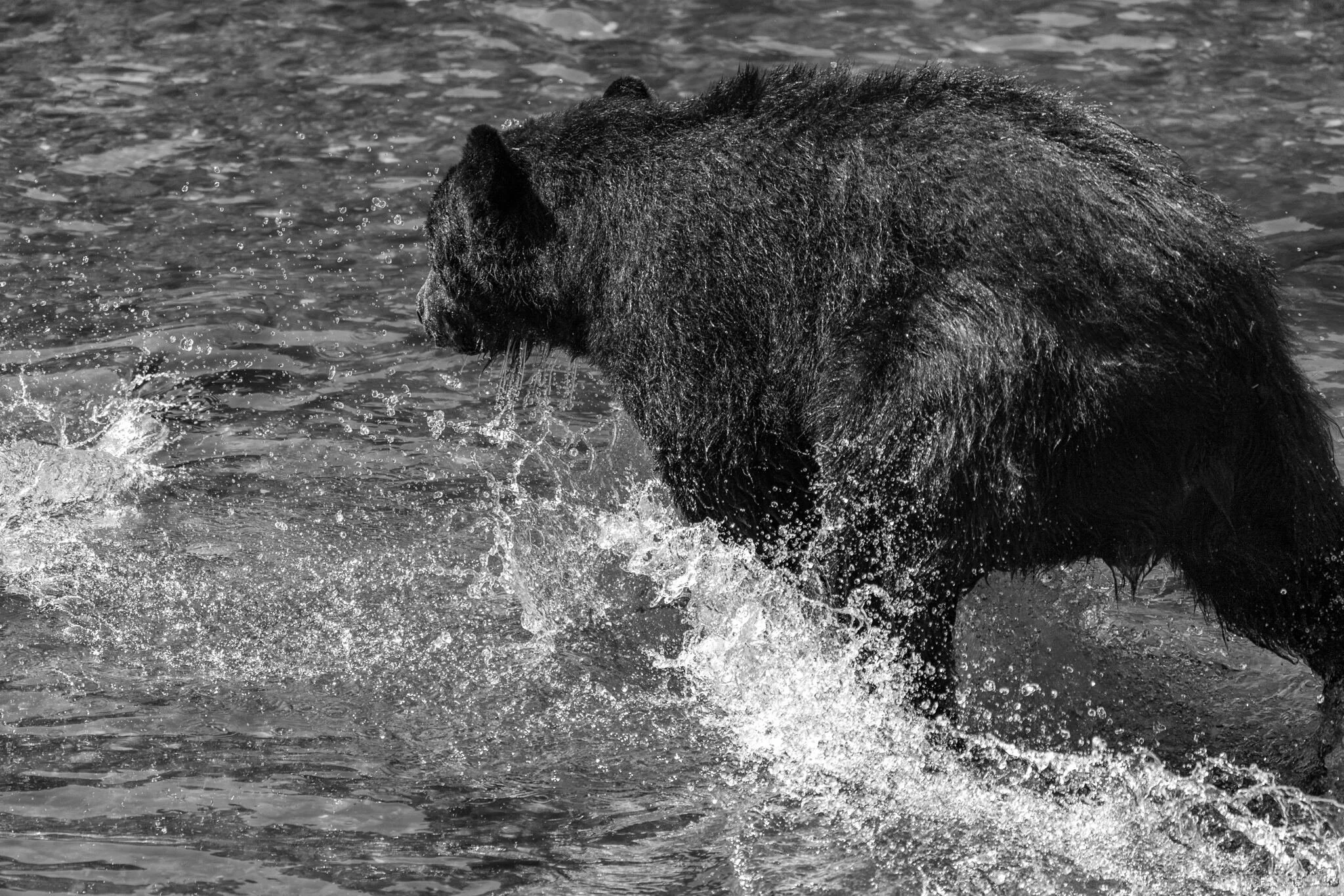
By the time they reach the final stretch before the hatchery, the salmon are exhausted, but the greatest danger yet lies ahead: Bears with an enormous appetite and a particular taste for seafood.
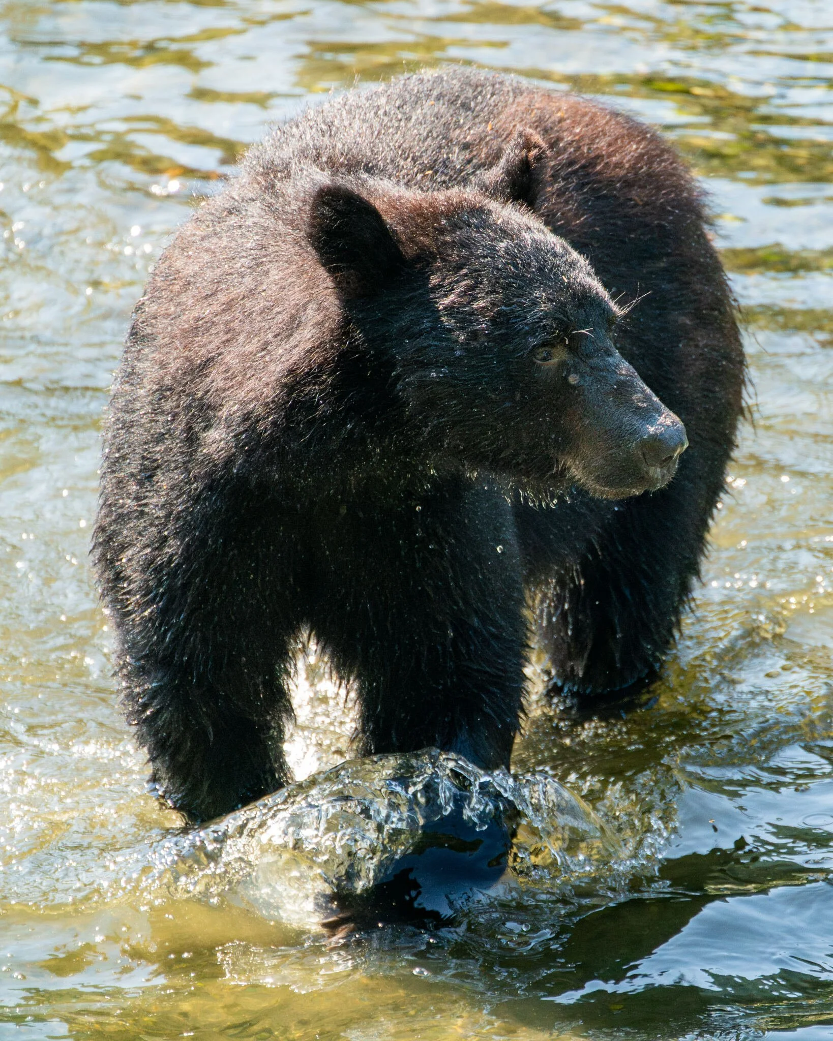
The American Black Bear. It’s the end of summer, and this adolescent male wades through a shallow river, looking for pink salmon. Not that they’re hard to find. At this time of year, thousands of pink salmon return from the ocean, migrating back upriver to their hatcheries. From above, the fish look like floating objects until they move, swimming furiously for a couple seconds before resting again. It can take hours just to move a couple feet - perfect for a bulking bear.
A local resident and celebrity. The bear wanders through yards and paved roads, picking through trash cans. Life’s a lot easier in late summer. Ketchikan being the “salmon capital of the world”, food is plentiful. Salmon rest on their way upstream - easy pickings.
He wades through a river while the fish move aside, both predator and prey saving their energy until the last second. The bear leaps, paws outstretched, and the salmon dart away as soon as his shadow blocks the sun. Luckily for him, they’ve got nowhere else to go.
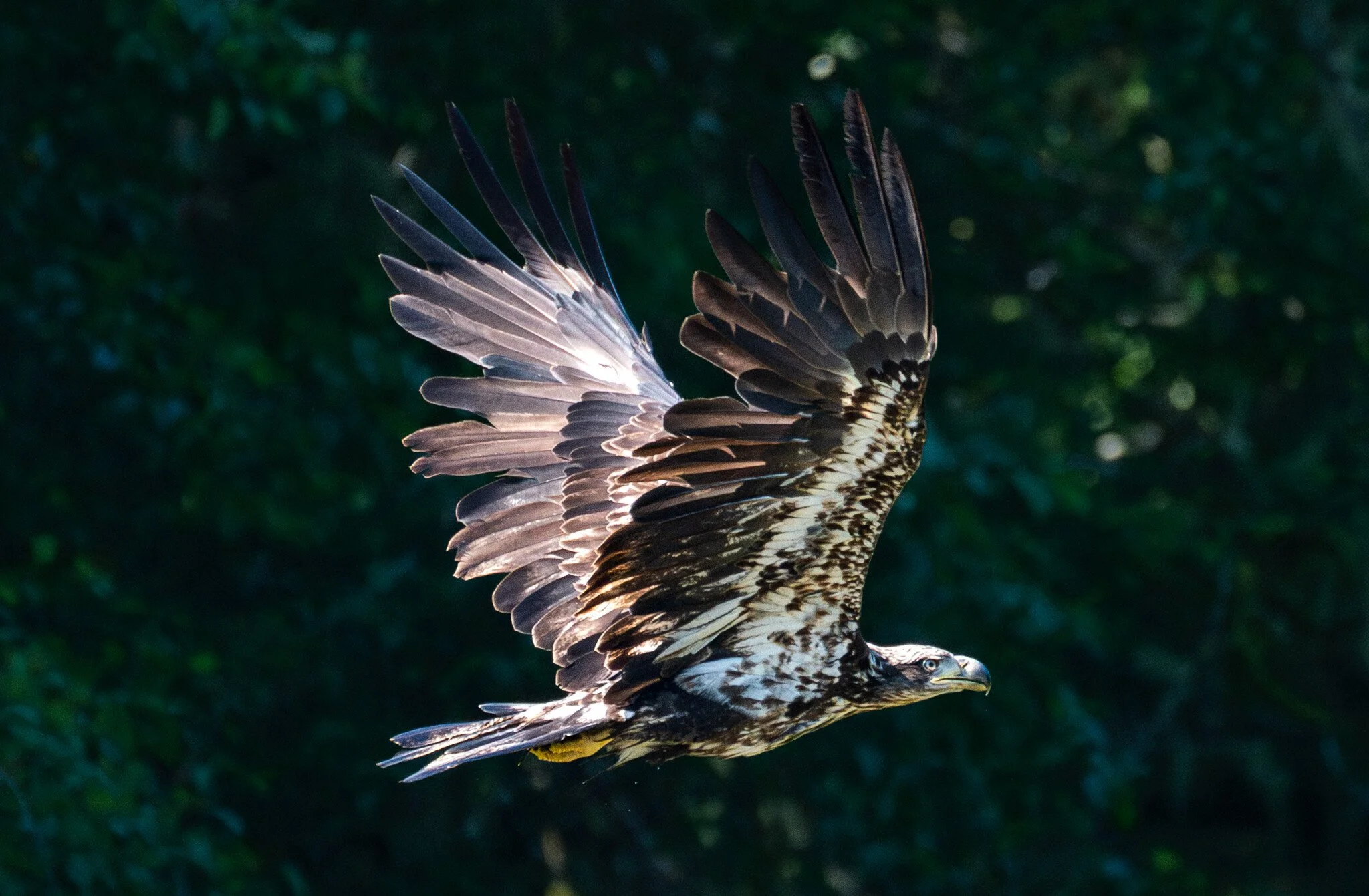

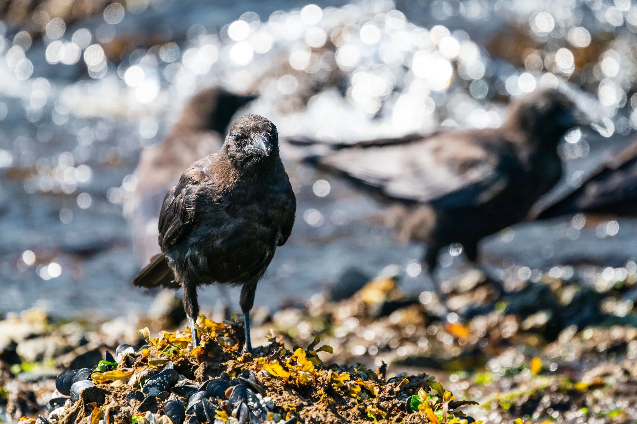
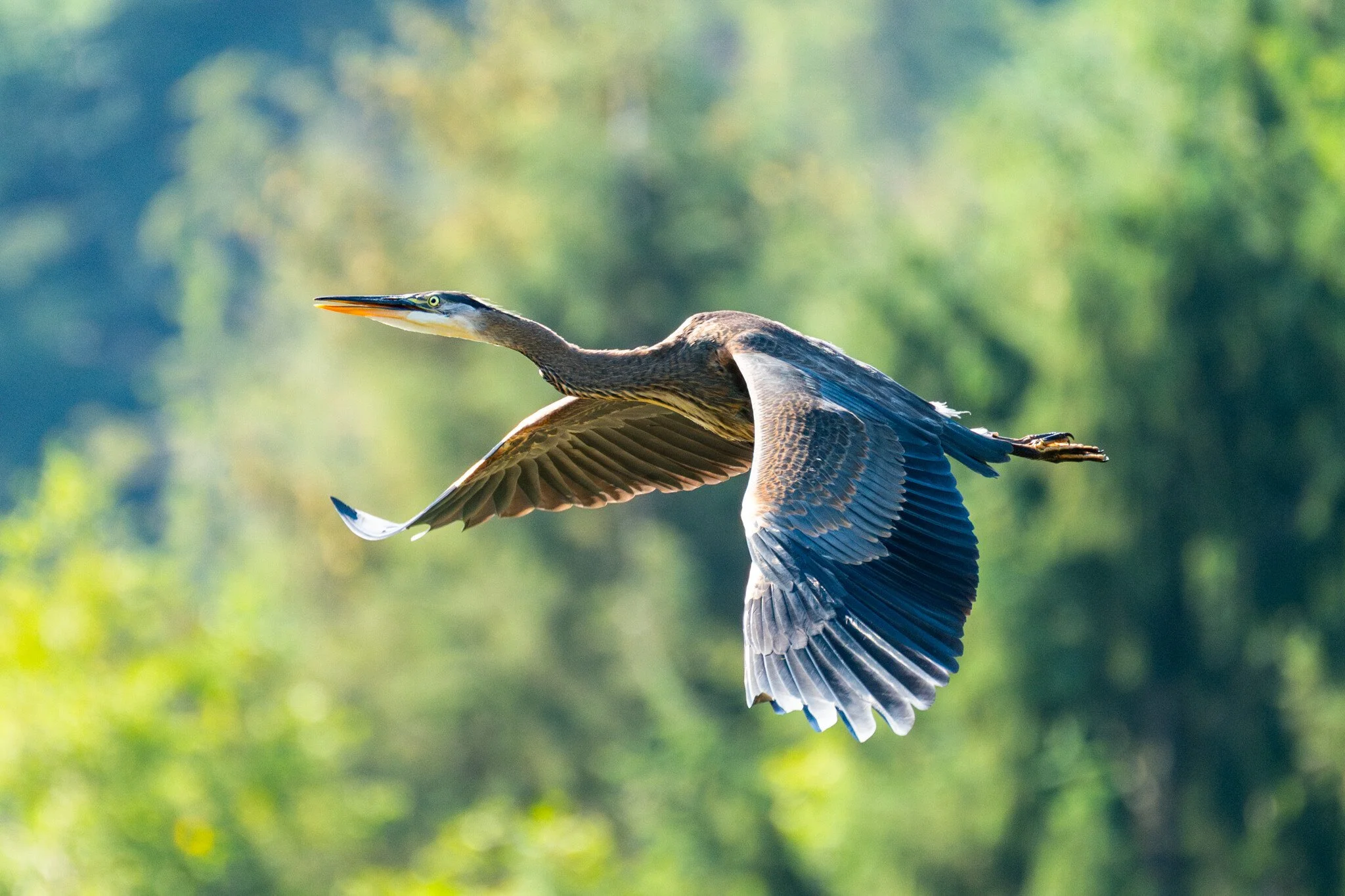
The birds of Ketchikan never stray far from the salmon. Bald eagles (top left, top right) perch mere feet from the bears, waiting for them to finish eating their catch before swooping in and fighting over the carcass. Great blue herons (bottom left) wade through the shallow water, hunting down the weakened fish and picking at remains. Further downstream at the river’s delta, American crows (bottom right) congregate around the bodies of countless dead salmon washed ashore.
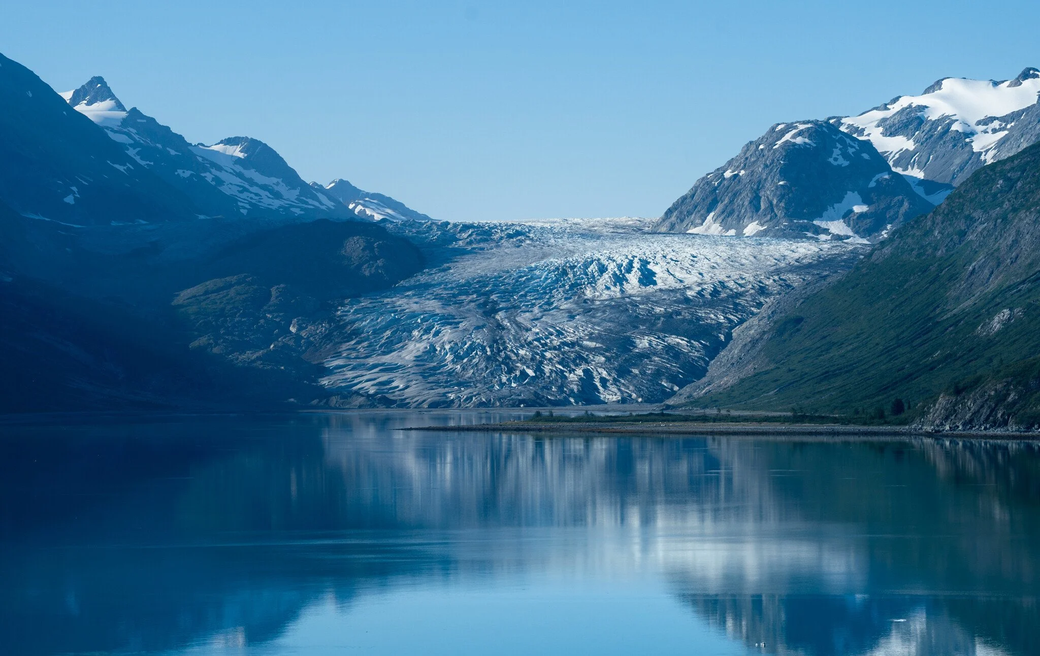
The rising ocean
T h e L i f e c y c l e o f a G l a c i e r
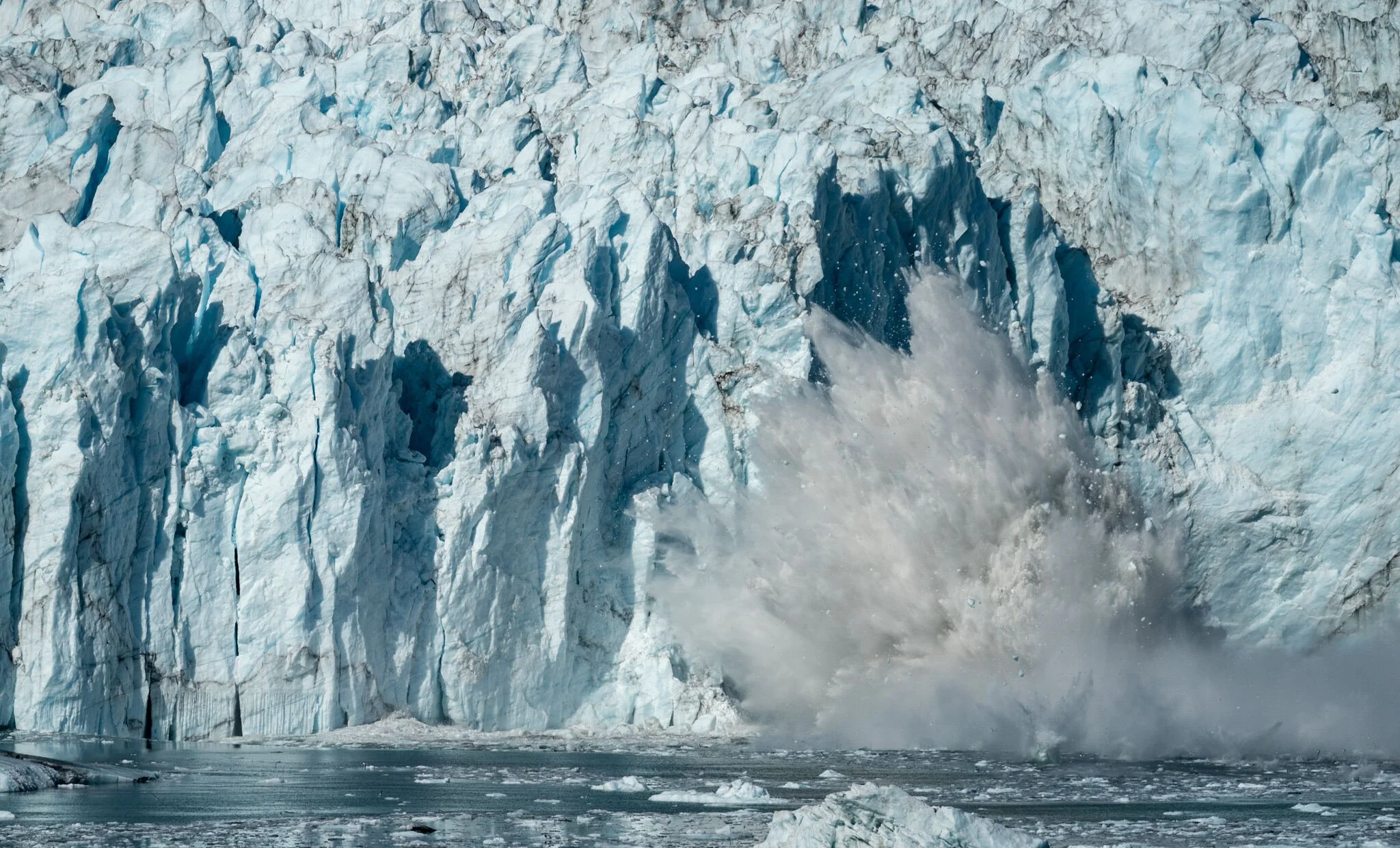
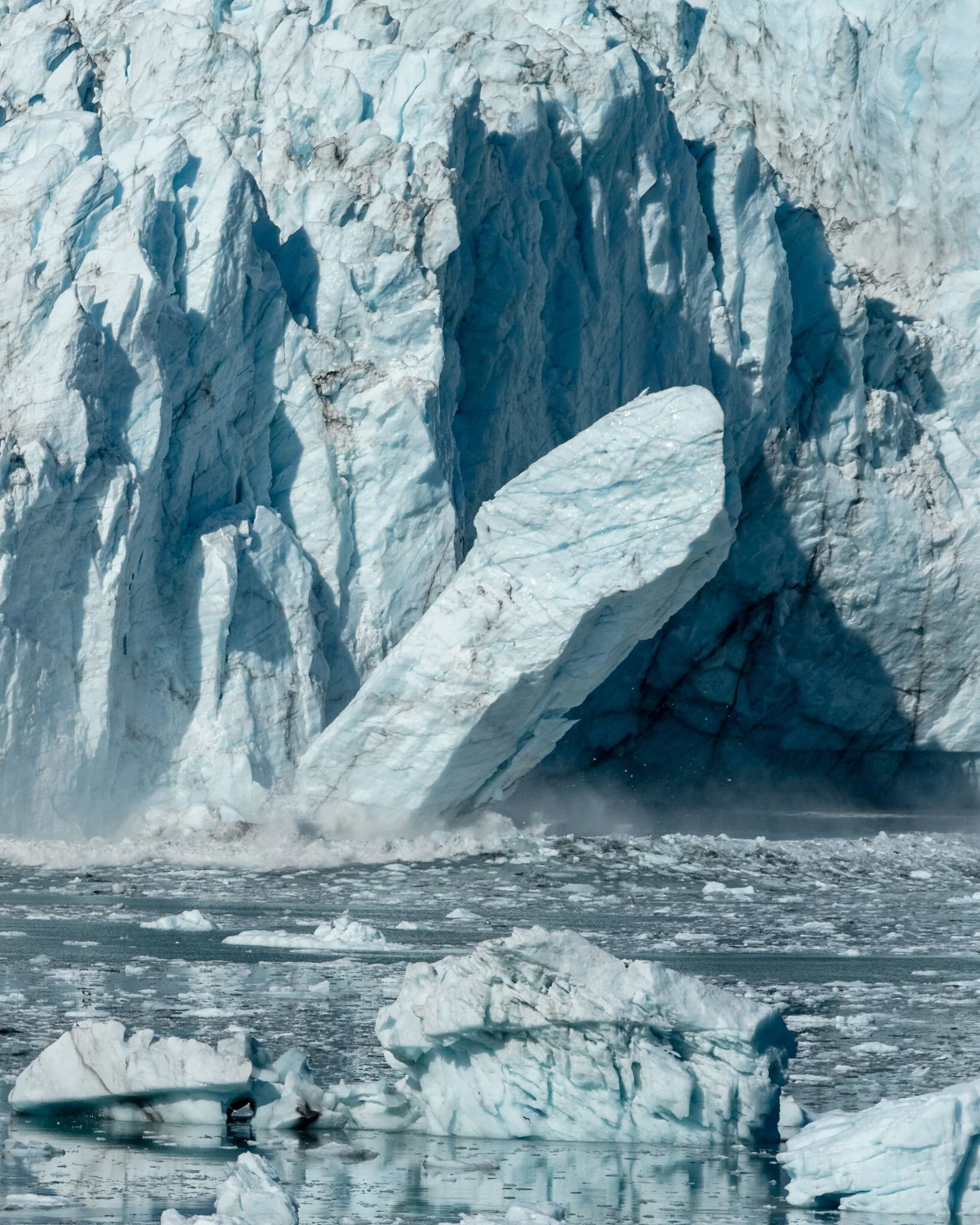
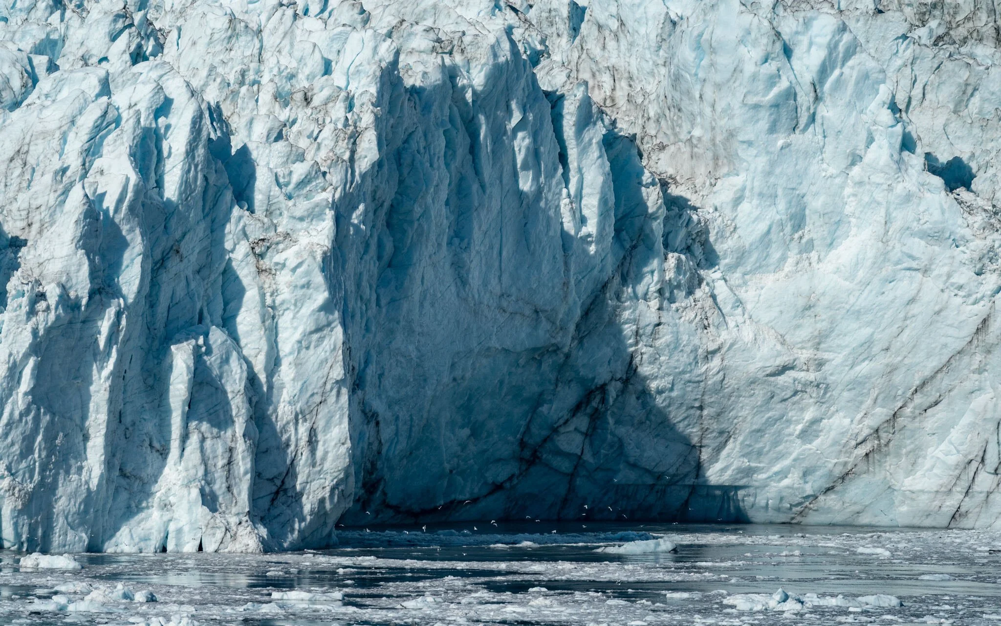
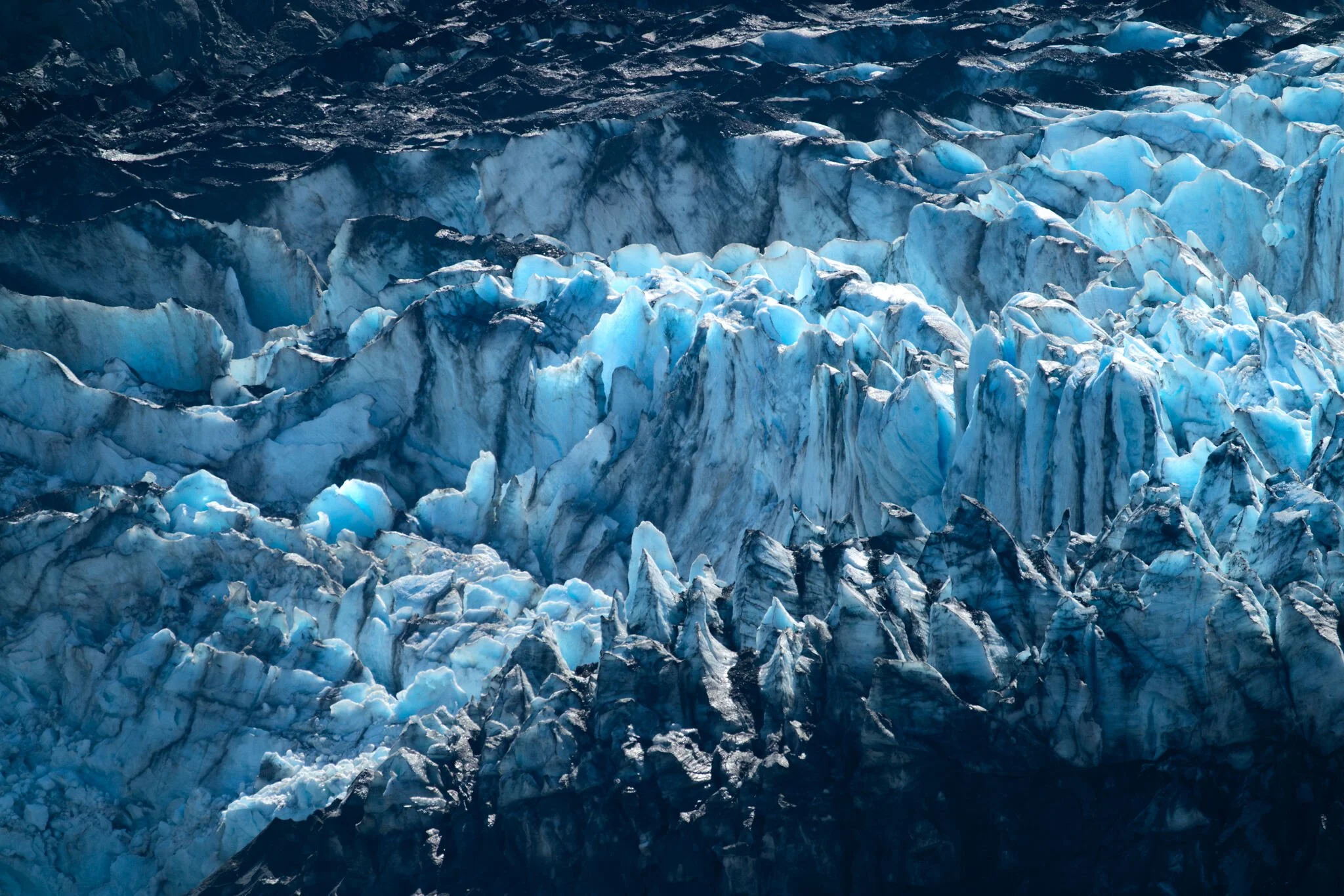
I came at a perfect time. Our captain, with 40 years of Alaskan sailing under his belt, hadn’t seen two weeks of clear, sunny weather in Glacier Bay National Park for decades. Our guide had only seen weather like this when he first moved to the Panhandle. That was 30 years ago, before he started a family. The result of unending sunlight? Icefalls.
Slabs of ice the size of semitrucks carve away from the glacier, slowly at first then with great momentum as they strike the water. An explosion of water rises up, sending seagulls and shrapnel careening away from the wall. The face is transformed, again and again as temperatures continue to warm.
All above: Margerie Glacier
Millenia ago, the Margerie Glacier began, like every other glacier, as a thick accumulation of snow. Over thousands of years, the snow packed down enough to become glacial ice. One hundred feet of this ice caused the mass to slide downwards due to its own weight. This mass has become a glacier.
The Margerie Glacier had yet to form its own identity - the Little Ice Ace (1550 AD - 1850 AD) caused extreme growth in all glaciers in the region, merging them into a single ice sheet that enveloped the entire bay. This was the same ice sheet that George Vancouver mapped in 1794, and by John Muir’s exploration of the Bay in 1879, the ice sheet had retreated 48 miles due to the warming climate. As the ice pulled back, the Margerie Glacier was born, now an individual arm of the original glacier.
Today, the ice sheet has retreated 65 miles. However, the Margerie Glacier is stable and in equilibrium, meaning snow accumulation and melting are roughly equal. It stretches 21 miles long and stands 350 feet tall at the face. This classic tidewater glacier is one of the most active calving glaciers in Alaska, constantly sending icefalls (“white thunder”) down into Tarr Inlet.
Margerie Glacier
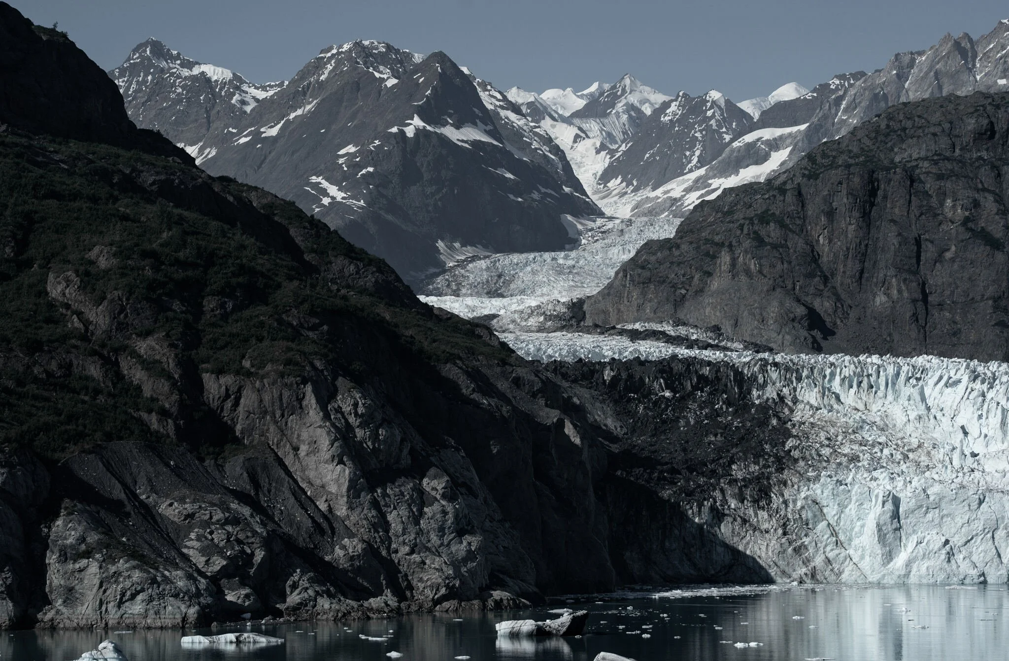
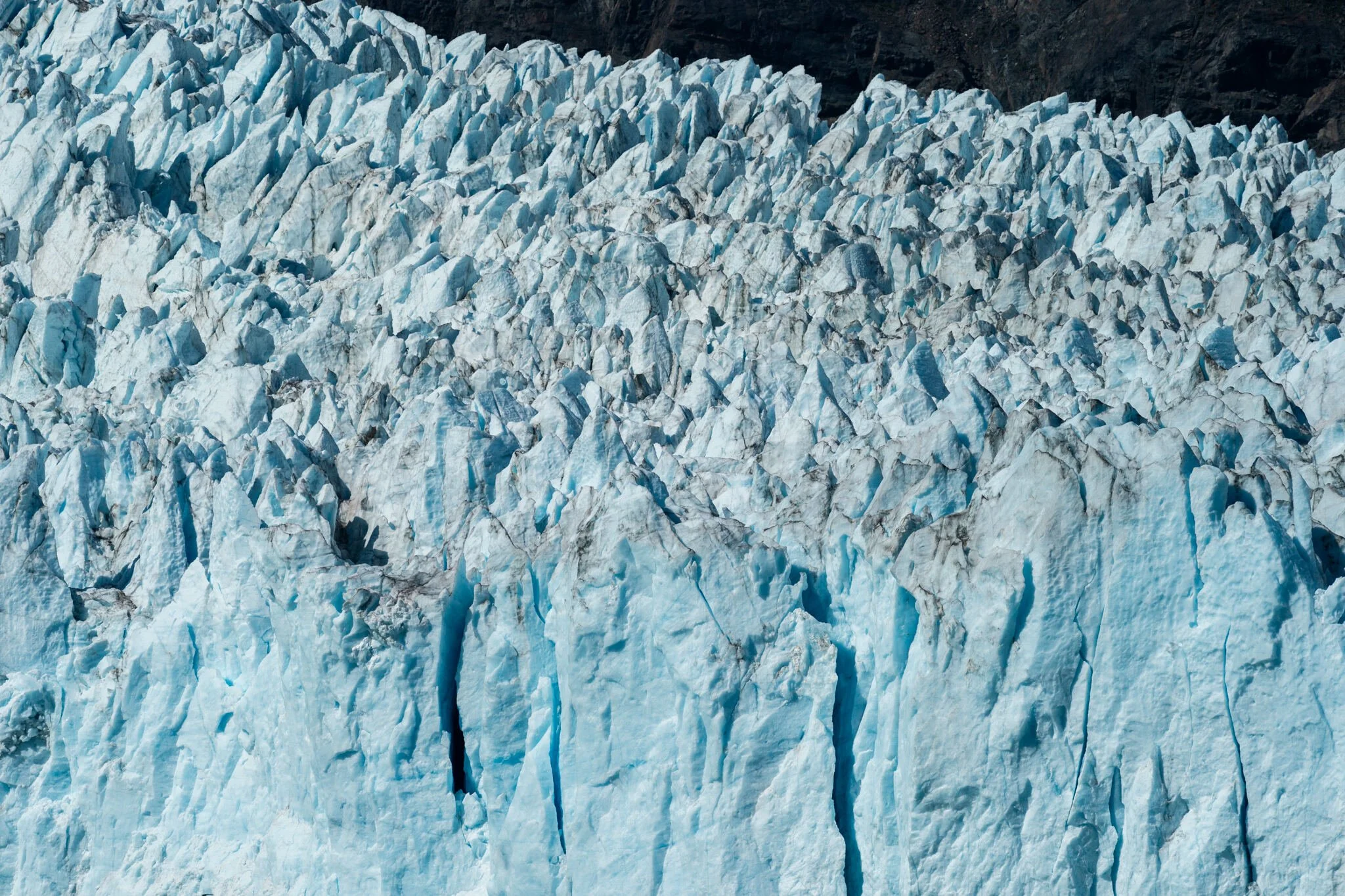
Lamplugh Glacier
Vibrant shades of blue and black define the Lamplugh Glacier. These are medial moraines - dark stripes of debris that the ice flow scrapes from mountain walls.
This glacier is receding up to 100 feet each year, creating mudflats in front. While the “grounding” produces new space for wildlife to navigate, the increased warming has caused landslides - over 120 million metric tons of rock collapsed in 2016, detected by seismometers around the world.
Lamplugh Glacier
Reid Glacier
The “Gold Miner’s Glacier.” After the initial Yukon Gold Rush faded away in 1899, prospectors spread out into the surrounding wilderness. Joseph Ibach struck gold - literally - high on the mountainside next to Reid Glacier. He set up mining operations to extract the vein and worked until the late 1950s. The rusted equipment and cabin remain there today.
The rapid glacial recession is obvious in the image, at a rate of 30-50 feet per year. Now, only the center third of the ice makes contact with the water at high tide.
Reid Glacier
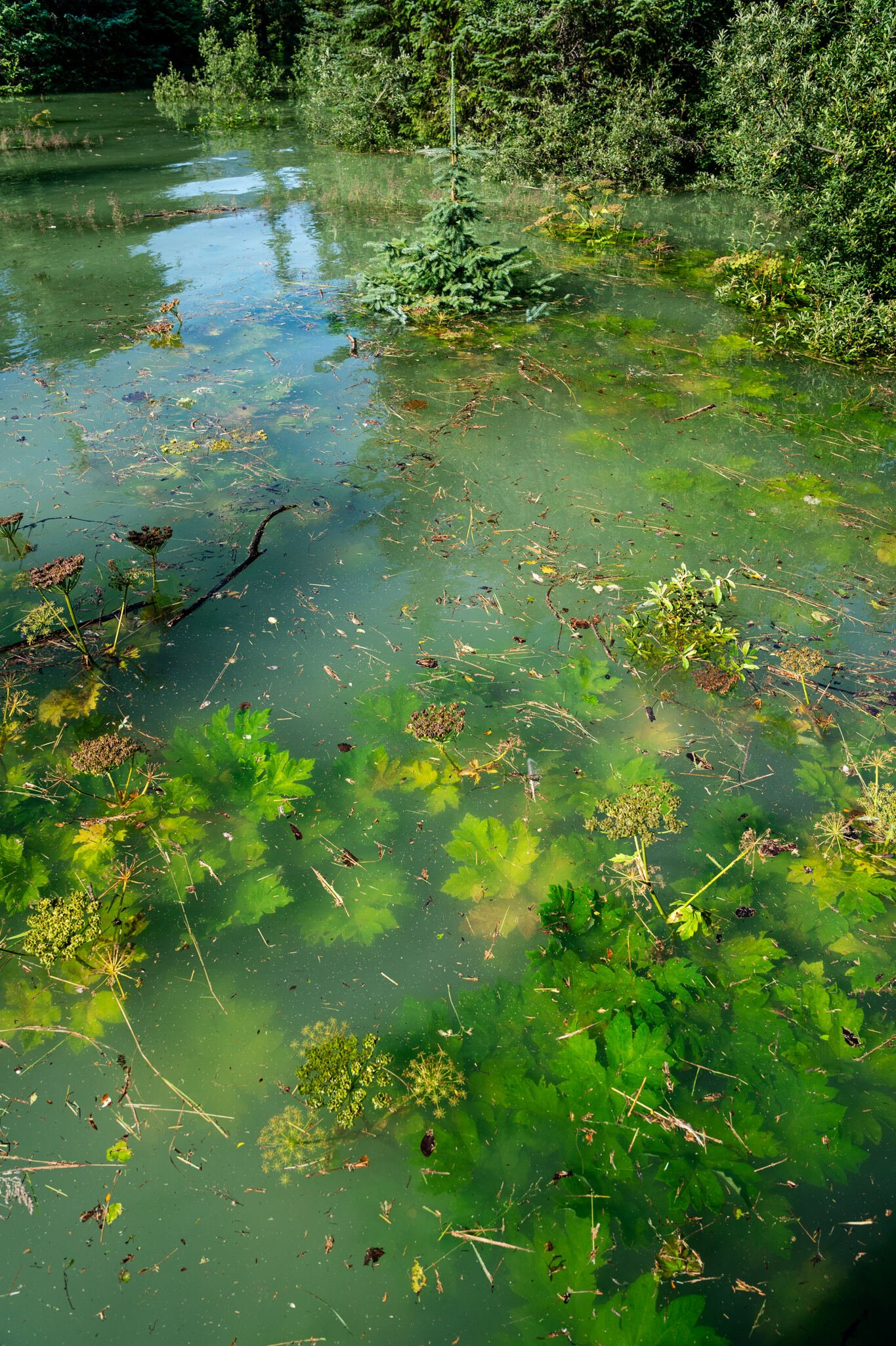
A flooded forest
In August 2024, the glacial dam of Suicide Basin collapsed, releasing 14.6 billion gallons of accumulated meltwater down Mendenhall Valley. Over 100 homes and multiple roads in Northern Juneau were inundated, as well as most Mendenhall Glacier hiking trails.
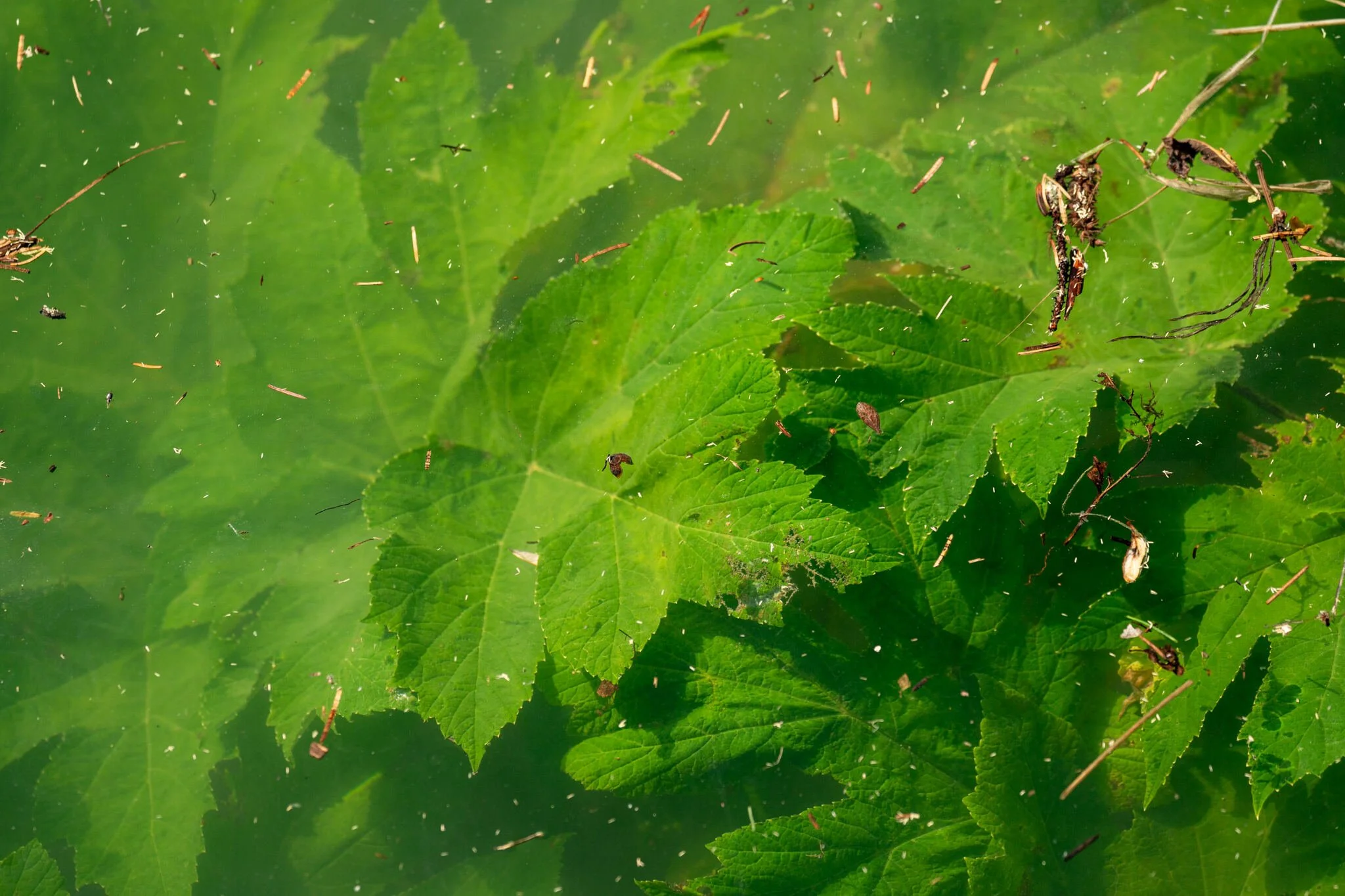
I visited the area soon after the catastrophe. Although the water had retreated in Juneau, Mendenhall Lake remained swollen. Entire trails were flooded. The flora in the image aren’t aquatic plants - they’re the tips of trees. A Sitka spruce (Picea sitchensis) pokes out in the center, while cow parsnip (Heracleum maximum) are fully submerged in the foreground. Dead debris from the forest floats through milky glacial water.
Located in the panhandle of Alaska, the valley isn’t new to basin flooding. In fact, this has occurred every year since 2011. But, like most climate-driven disasters, the scale and damage increased over time. As Mendenhall Glacier retreats, more of the basin opens up to collect a greater amount of water. Higher temperatures mean that the basin fills quicker; the glacial wall holding back the volume is thinner.
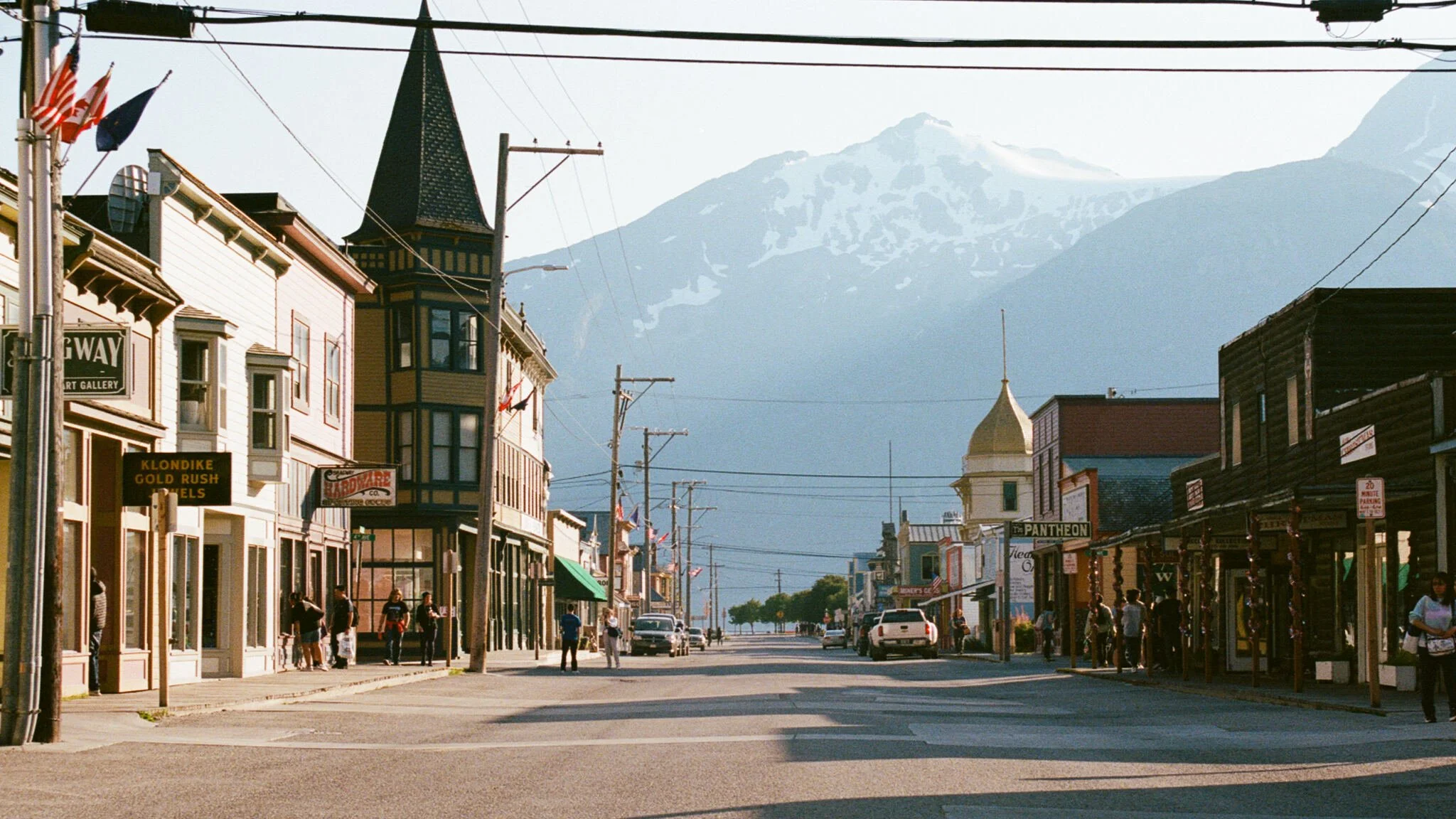
While the state couldn’t be farther than the States, many cities in Alaska have a distinct “Wild West” vibe. Old saloons still stand from the days of the Klondike Gold Rush, when 30,000 people made their way into Yukon territory, setting up camps along the way. Starting in Skagway, stampeders made a grueling, deadly trip up the Dead Horse Trail only to return empty handed - there was little gold in the Yukon.
Trading posts in each town sell moose, bear, deer skins; these days, much of the population stay only for the summer, when tourist season is at peak.
This image was shot on a Canon AE-1 Program with Kodak Gold.
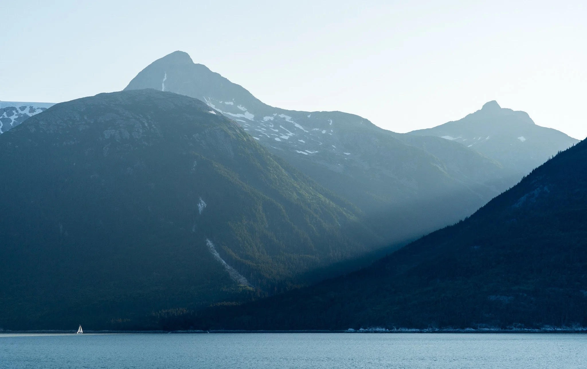
Skagway
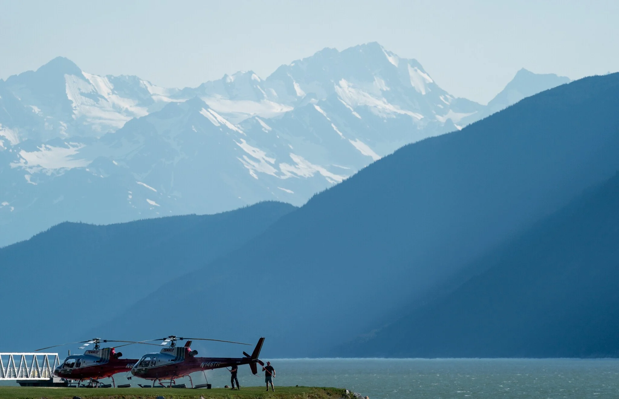
Sightseeing
Helicopter tours are a popular sector of the tourism industry in Alaska.
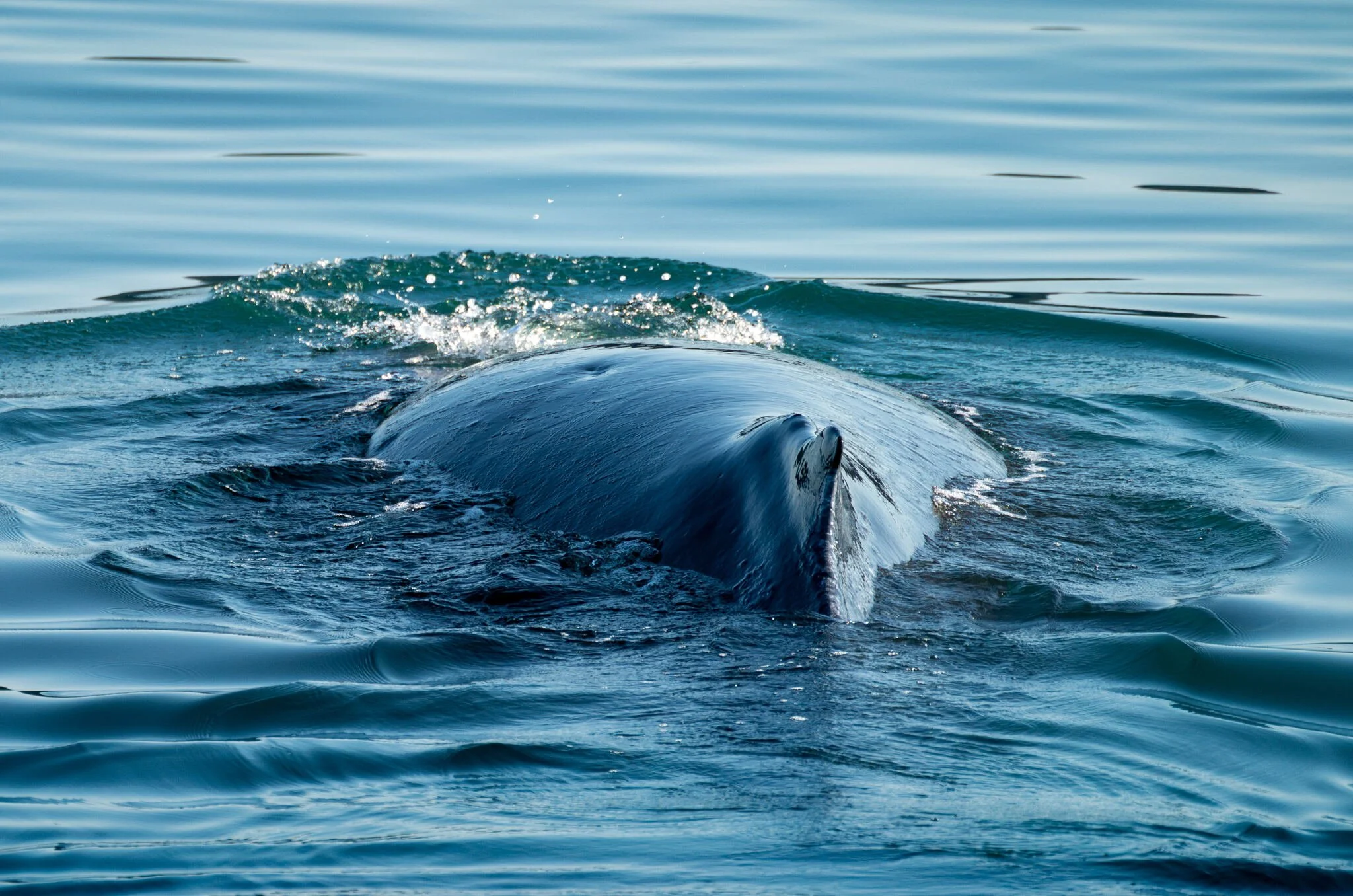
Sighting
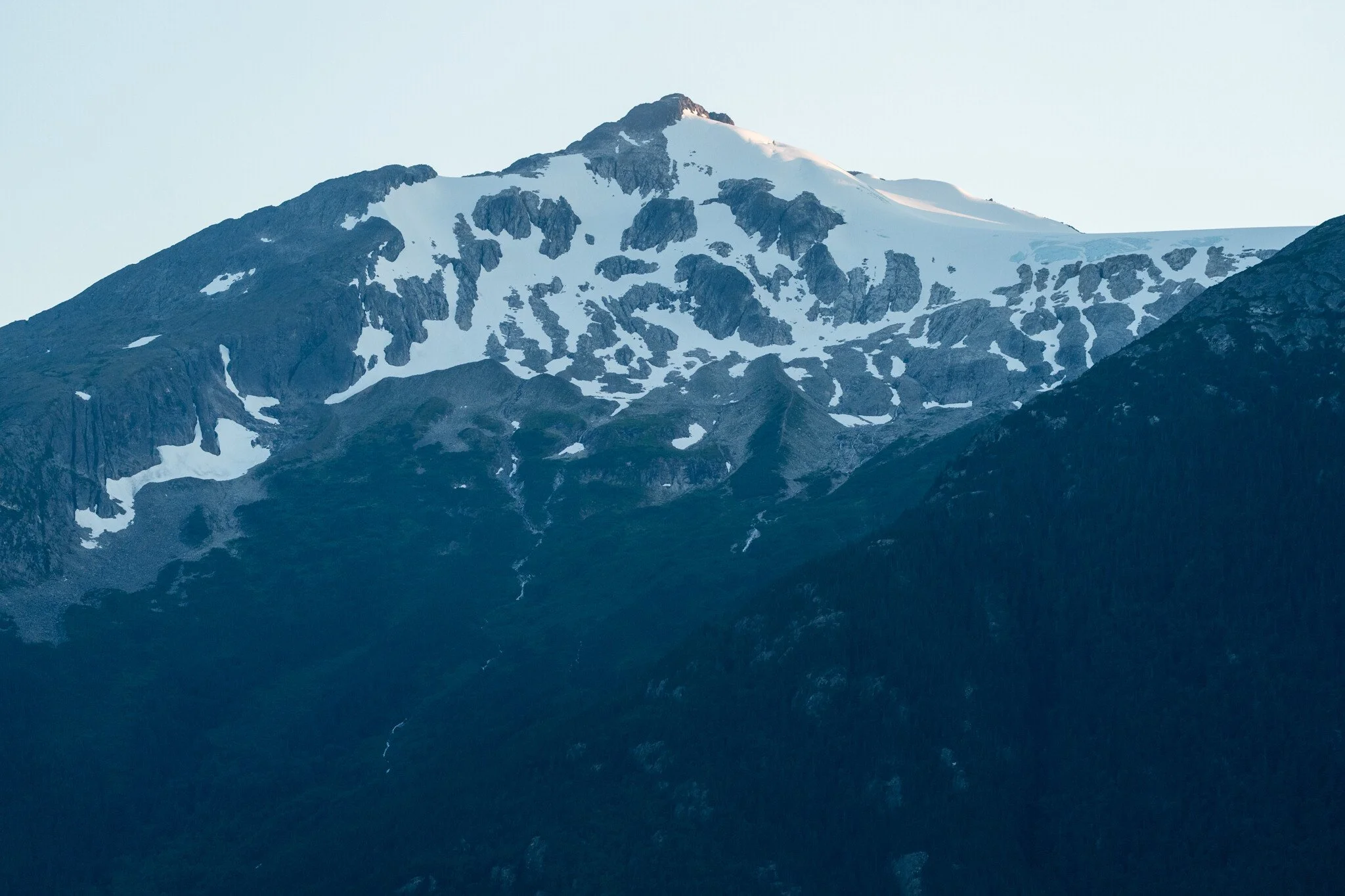
Blue Hour